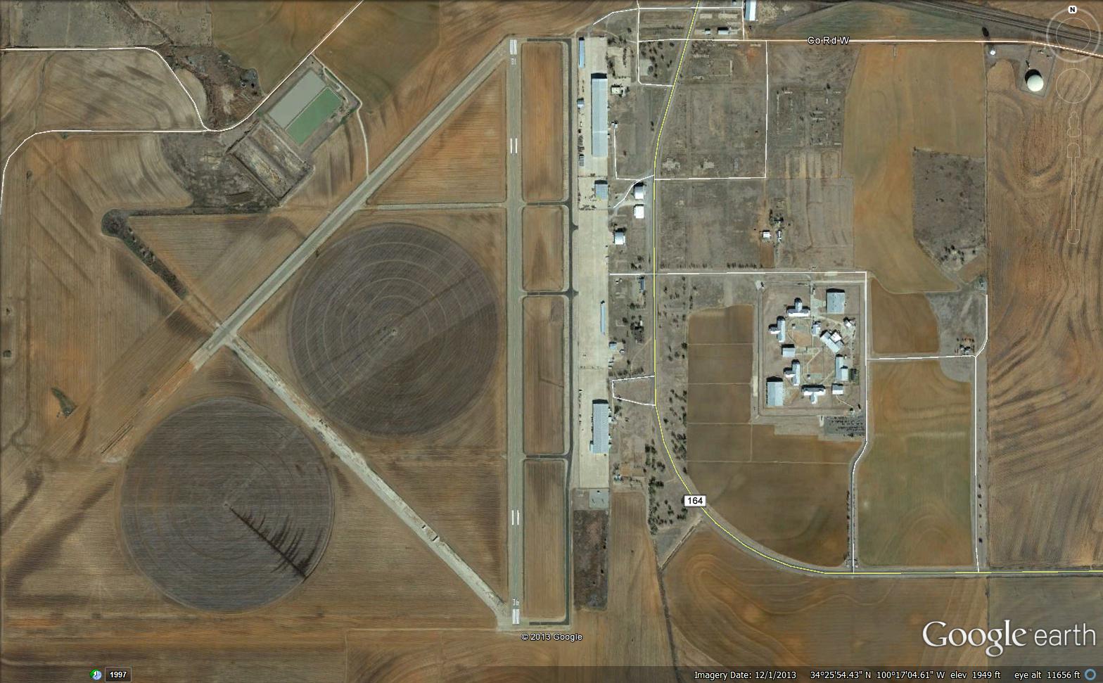
North Texas Regional Airport / Perrin Field[2] (IATA: PNX, ICAO: KGYI, FAA LID: GYI) is a county owned, public use airport in Grayson County, Texas, United States. It is located between the cities of Sherman and Denison.[1] Formerly known as Grayson County Airport, the airport was renamed in November 2007.[2] It is used entirely for general aviation purposes. Several of the buildings are occupied by businesses, Grayson County government agencies, as well as Grayson County College.
Although most U.S. airports use the same three-letter location identifier for the FAA and IATA, this airport is assigned GYI by the FAA and PNX by the IATA[3] (which assigned GYI to Gisenyi Airport in Gisenyi, Rwanda).[4]
As a general aviation reliever airport, unconfirmed reports suggest that the airport might potentially (in the distant future) serve as a third airport for the Dallas/Fort Worth Metroplex to handle travelers from its growing northern suburbs. If this occurs, commercial traffic would be focused on regional jet airline operations. A planned extension of State Highway 289 would pass the airport on the west side.
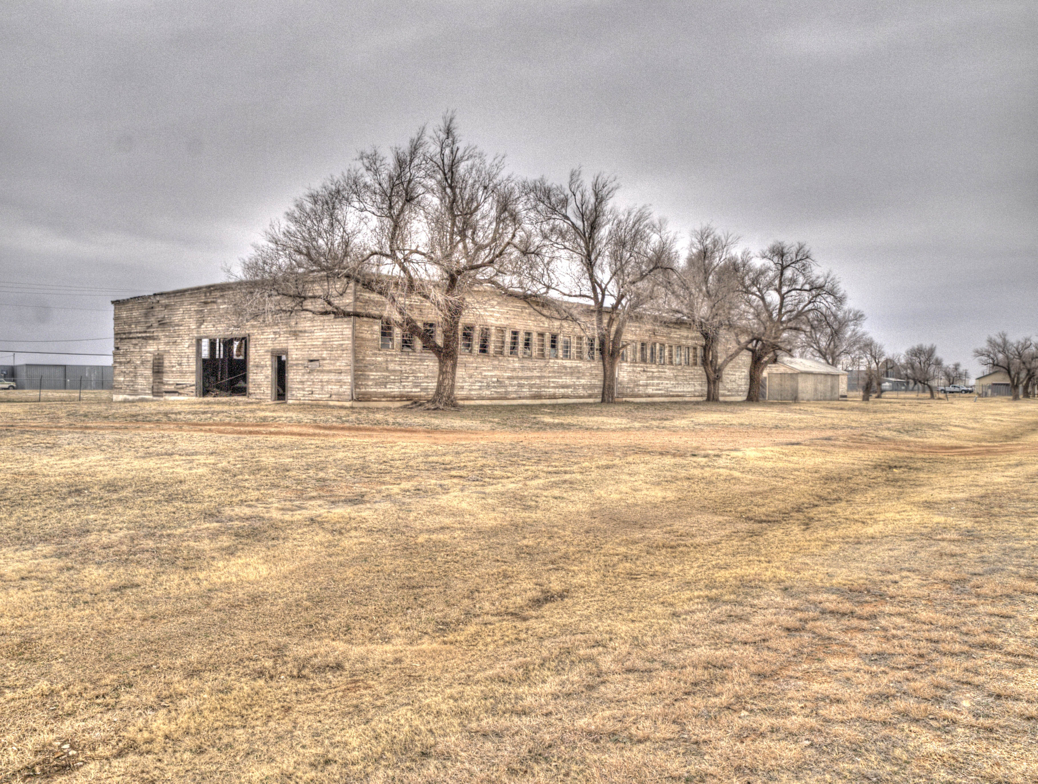
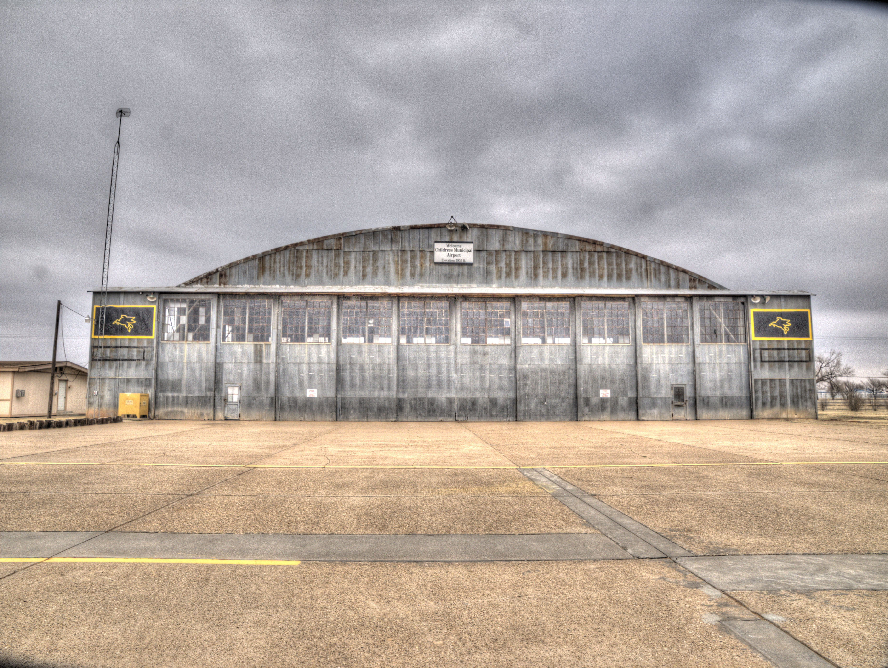
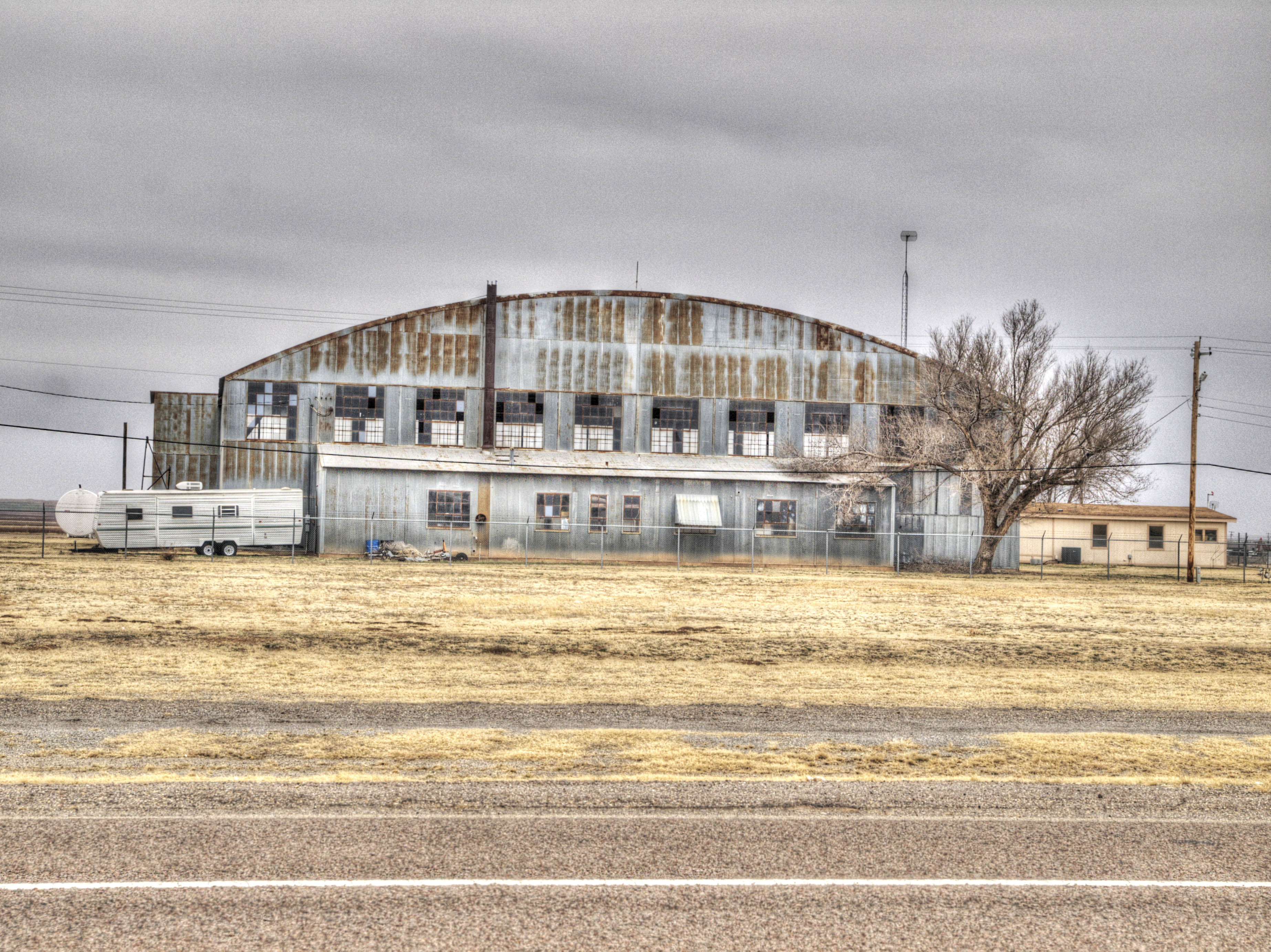
For usage of airport before 1971, see Perrin Air Force Base.The airport is located on the site of the former Perrin Air Force Base, which was built in 1941 and closed in 1971.[5] Since the closure, a small group of local Sherman and Denison citizens have held the memory of Perrin together, hosting nine Perrin Field reunions since the early 1980s. The Perrin AFB Research Foundation was established in 1998. Today, in addition to serving as a general aviation airport, several businesses, as well as a juvenile detention center/boot-camp and adult probation center are built upon former barracks and nearby areas. There is a small museum dedicated to the former Perrin Air Force Base at the airport and Grayson County College uses several of the buildings for its course offerings. The college also operates the former base golf course.
After seeing the fighters take off from here as a young man, noted aviation expert Chesley Sullenberger (best known as the pilot of US Airways Flight 1549) became interested in flying.[6][7]
On 16 June 1941, the Office of the Chief of the Air Corps drew up a program for construction. A tentative authorized strength of 199 officers, 422 cadets, 1730 enlisted men, and funds in the amount of $3,966,833.00 were ordered and set aside for the construction of the airfield. The lease was signed by the United States Government and Grayson County on 1 July 1941 and the Army Corps of Engineers started construction on the newly established Grayson Basic Flying School the same week.
On 9 August 1941, Major Robert J. Warren was the first person to report to duty at the partially constructed airfield, assuming duties as project officer and temporary Commanding Officer. Ten days later, five enlisted men arrived from San Angelo, TX, to assist Major Warren in the development of the airstrip, hangars, barracks, and field headquarters building.
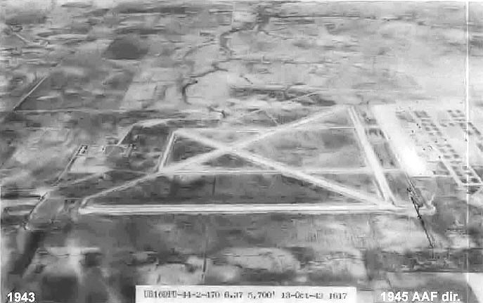
The airfield was laid out with four runways in a triangle pattern, consisting of 4500x150(N/S), 2700x150(NE/SW), 4200x150(E/W), 5137x150(NW/SE), all constructed of concrete. A large parking apron was constructed to accommodate the planned basic (phase II) training aircraft with at least 6 maintenance hangars and supporting buildings. East of the airfield, a ground support station was constructed consisting of about several hundred buildings based on standardized plans and architectural drawings. The buildings were designed to be the "cheapest, temporary character with structural stability only sufficient to meet the needs of the service which the structure is intended to fulfill during the period of its contemplated war use." To conserve critical materials, most facilities were constructed of wood, concrete, brick, gypsum board and concrete asbestos. Metal was sparsely used. Perrin Field was designed to be nearly self-sufficient, with not only hangars, but barracks, warehouses, hospitals, dental clinics, dining halls, and maintenance shops were needed. There were libraries, social clubs for officers, and enlisted men, and stores to buy living necessities.